AuKing Completes 330km Drone Survey Over Tundulu Carbonatite Complex
AuKing Mining has wrapped up a drone-based magnetics and LiDAR survey across its Tundulu rare earths project, setting the stage for a drilling campaign targeted for May. The high-resolution data aims to sharpen drill targeting within the 5km carbonatite complex.
- Drone survey covers entire Tundulu carbonatite complex
- Survey data processing to complete within 7-10 days
- Drilling preparations underway with community engagement
- Survey to refine targets for rare earth element mineralisation
- Drilling planned to start in May pending final approvals


Drone Survey Unlocks Subsurface Clues at Tundulu
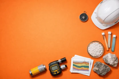
AuKing Mining (ASX:AKN) has completed a significant airborne survey using drones to map the magnetic and topographic features of its Tundulu rare earth elements project in Malawi. Covering a 5-kilometre diameter carbonatite intrusive complex, the survey is designed to reveal the subsurface architecture and structural controls that influence mineralisation. This marks the first on-site activity since AuKing secured the project, following the recent high-grade Tundulu acquisition.
The survey employed a DJI M300 RTK drone platform, flying approximately 330 line kilometres over 10 days. Magnetic data was collected on 50-metre spaced flight lines at about 45 metres altitude, while LiDAR data was captured on 100-metre spaced lines at 90 metres altitude. These high-resolution datasets are expected to provide a detailed picture of the carbonatite intrusions and regolith development, crucial for refining drill targets across known and interpreted mineralised hills such as Nathace, Makhanga, and Ichigwakalu.
Data Processing and Drilling Plans Take Shape
The raw data has been outsourced to an independent geophysical consultant for processing, with final products including levelled magnetic maps and 3D inversions anticipated within the next week to ten days. AuKing plans to integrate these new insights with historical drilling data to confirm and potentially expand mineralised zones. Drill program planning is well advanced, with discussions ongoing with preferred contractors and logistical arrangements progressing in parallel.
AuKing aims to commence drilling in May, pending finalisation of drill targets and securing necessary approvals. Early engagement with local community leaders and regulatory bodies has already taken place, reflecting the company’s emphasis on collaborative development. The drone survey itself included community interaction, with local residents shown the equipment and involved in the process, signalling a commitment to social licence as exploration intensifies.
Community Engagement and Project Momentum
Local community involvement is a cornerstone of AuKing’s approach at Tundulu. The company has documented interactions with township residents and children during the drone operations, underscoring the importance of building trust ahead of more invasive activities like drilling. This groundwork may prove crucial as the project moves from survey to subsurface testing, where environmental and social considerations often come to the fore.
With the airborne survey data imminent, the next few weeks will be critical for translating geophysical insights into concrete drill targets. The success of this phase could materially impact the trajectory of AuKing’s maiden drilling campaign at Tundulu, which itself follows the company’s strategic acquisition and $3 million placement to fund exploration activities.
Bottom Line?
The drone survey sets a technical foundation, but the real test lies in how the data shapes drilling outcomes and community acceptance in the coming months.
Questions in the middle?
- Will the airborne data reveal new high-grade zones beyond historical drill footprints?
- How quickly can AuKing mobilise drilling given logistical and regulatory hurdles?
- What level of community support will be maintained as drilling intensifies?